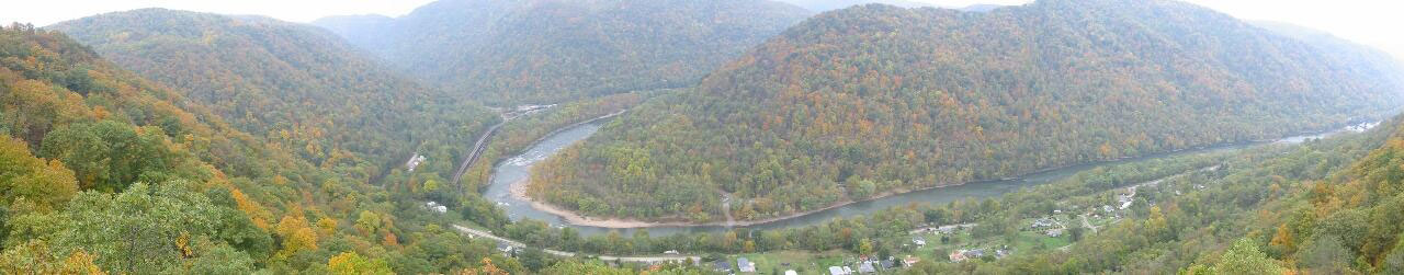
Fig. 1. Panoramic view of Quinnimont and Grandview Sandbar (New River Gorge National River, West Virginia, USA). The forest fragmentation associated with the main road is detectable on land cover maps because the adjacent nonforest parcels are large enough to be detected on satellite images. The "subpixel" canopy gaps created by the unpaved road along the far shore of the river are too small to be detected. The national road map identifies more roads than are visible in this photograph, but it does not show the railroad along the near shore or the unpaved road along the far shore of the river. Photograph by Frank Sellers, courtesy of the National Park Service.