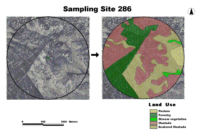
Fig. 2.
Example of Land variables generation: land-use types within a 1-km radius circle (Sample Site 286), extracted from aerial photographs. The arrow describes the process of photo interpretation.