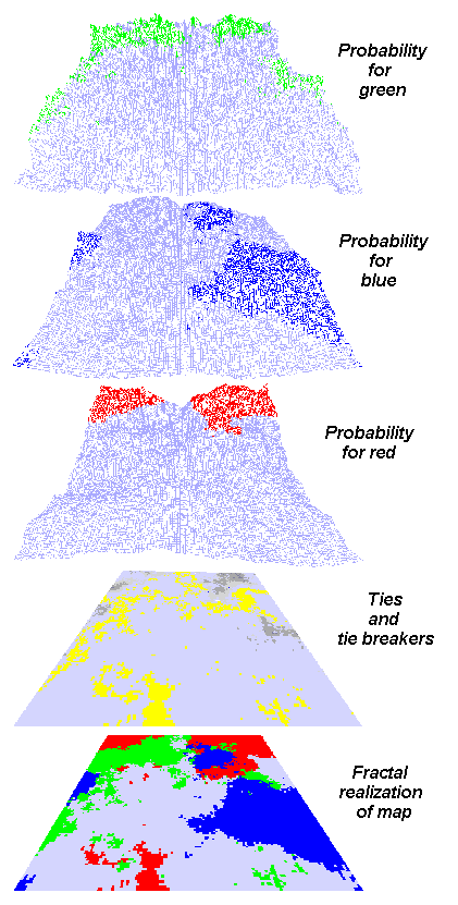
Fig. 4. A graphical example of the method used by the Fractal Landscape Realizer to produce a synthetic realization of a three-category map. The user requested that each of the three categories have a proportion of occupancy equal to 20% of the map (p = 0.20). The user also specified the fractal dimensions for the three categories to make them rough, intermediate, and smooth, from top to bottom. The colored portions of each probability layer represent the locations for the number of cells requested for each category. The high-probability sites for each category layer may overlap, creating ties. The fourth layer in
the stack indicates these ties as gray levels in which the darkness of the gray indicates the severity of the contention for that spot. The Fractal Landscape Realizer arbitrates these ties in the order of their severity, assigning losing categories to their next-highest unused cells (colored yellow in the fourth layer here). There may be more yellow cells (tie-breakers)
than gray cells (ties) because of three-way contentions. The red patch in the foreground of the final realization was not called for by the red probability layer, but was the result of arbitrage. The spatial statistics of all the categories are preserved within the final map.