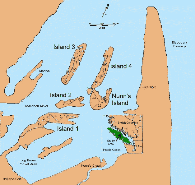
Fig. 2. Map of the study area showing the four constructed islands and Nunn’s Island. Lines and numbers on the islands indicate transects; on the constructed islands, solid lines denote transects through transplanted areas and broken lines denote transect through unplanted areas. The inset shows the regional location of the study area in coastal British Columbia.